Sedona — 10 Best Hikes in Sedona for Stunning Red Rock Views
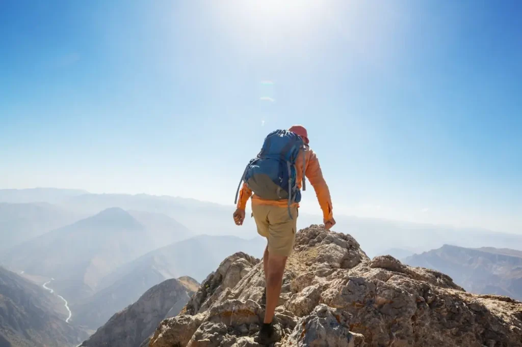
If you’re searching for the 10 Best Hikes in Sedona for Stunning Red Rock Views, you’re in the right place. This guide solves the biggest planning problems—too many trails, changing weather, and peak-season parking—by giving clear, actionable details for each trail, plus logistics, gear lists, and safety tips so you get the view without the guesswork.
Top 10 Best Hikes in Sedona for Stunning Red Rock Views (quick list)
- Cathedral Rock Trail
- Devil’s Bridge Trail
- Bell Rock Pathway
- Soldier Pass Trail
- West Fork Trail
- Boynton Canyon Trail
- Airport Mesa Loop
- Fay Canyon Trail
- Doe Mountain Trail
- Bear Mountain Trail
How to use this guide (hook + problem + promise)
- Hook: Want the classic red-rock photos and a safe, fun hike?
- Problem: Sedona has 200+ routes — which ones are worth your time?
- Promise: Each trail below includes distance, difficulty, parking & timing tips, pros/cons, and must-bring gear so you can plan a perfect day on the rocks.
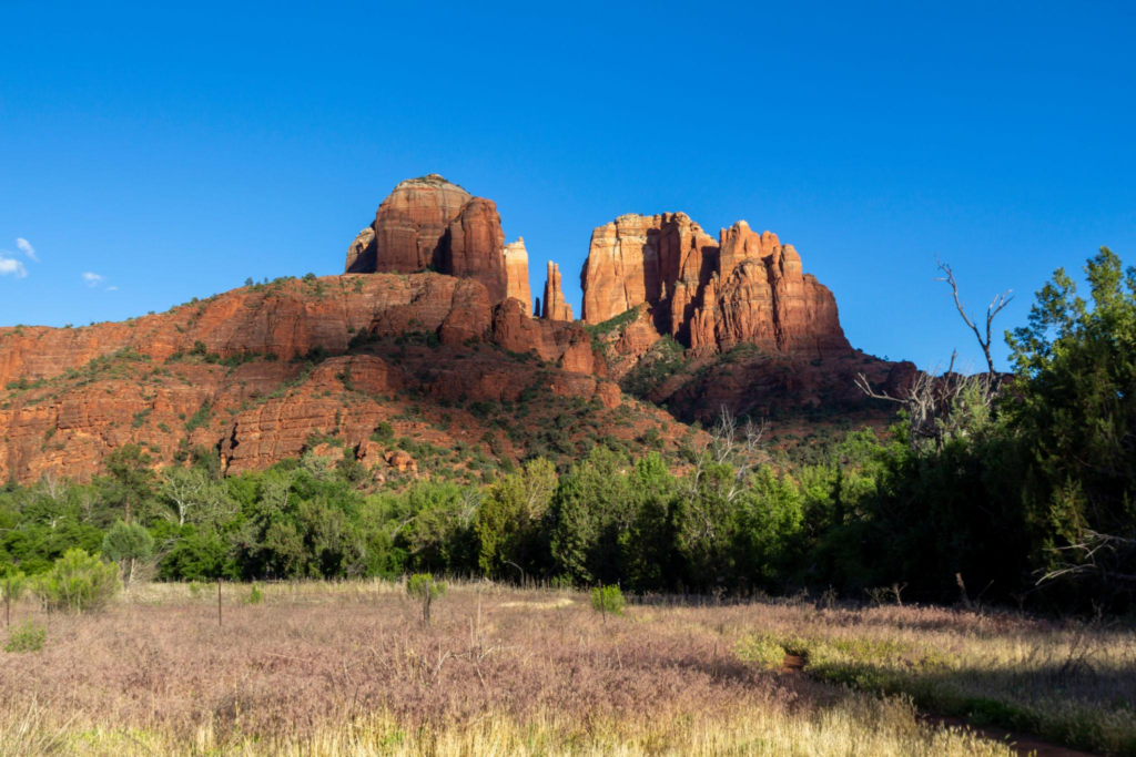
Cathedral Rock Trail — Cathedral Rock Trail
Distance & Time
- 1.2 miles round-trip (short but steep)
- Allow 1–2 hours including summit time
Difficulty
- Moderate → Strenuous (rock scramble sections)
Why go
- Iconic silhouette and sunset/sunrise photo ops
- Strong vortex reputation (popular for meditation/photos)
Trail details (points)
- Start at the Cathedral Rock trailhead (parking limited).
- Expect short, steep sandstone scrambles with iron-free handholds.
- Final section: exposed ledges — take your time and test each foot placement.
Best time & parking
- Best at sunrise/sunset for light and cooler temps.
- Arrive before 8:00 AM in summer or use the shuttle/alternate parking.
Gear & safety
- Shoes with sticky rubber, gloves for grip, 1L water minimum.
- Use hands for balance — not recommended for those with a fear of heights.
Pros / Cons
- Pros: Unbeatable vistas in a short time.
- Cons: Crowded, exposed sections.
Devil’s Bridge Trail — Devil’s Bridge Trail
Distance & Time
- ~4.0 miles round-trip (varies by trailhead option)
- 2–4 hours depending on stops
Difficulty
- Moderate — final approach is sandy/rocky
Why go
- Largest natural sandstone arch in the area — classic bucket-list photo
Trail details (points)
- Multiple access points: trailhead vs. 4×4 road (shortens hike).
- The walk across the arch is narrow — expect photo wait times.
- Bring a wide-angle lens for dramatic foreground and sky.
Best time & parking
- Sunrise or weekday mornings to avoid lines.
- Park at Dry Creek Road or the official trailhead if using the longer route.
Gear & safety
- Sun protection, plenty of water, and steady footwear.
- Avoid the arch when wet — sandstone gets slippery.
Pros / Cons
- Pros: Huge payoff for effort.
- Cons: Popular — plan for crowds.
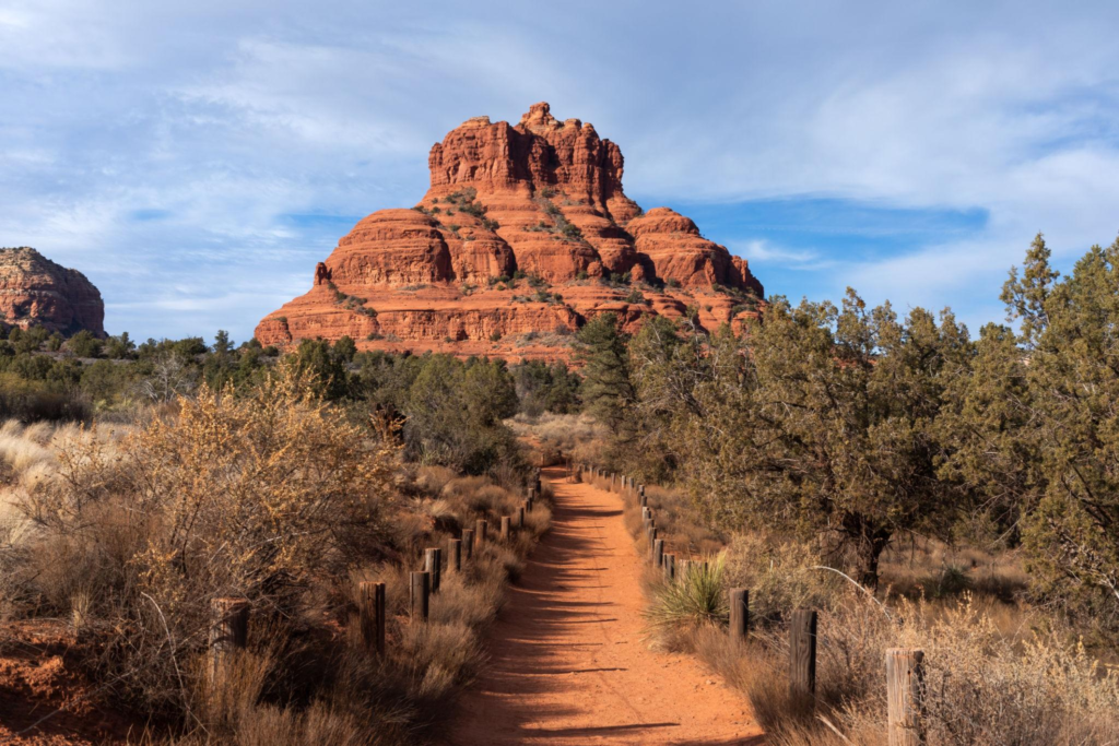
Bell Rock Pathway — Bell Rock Pathway
Distance & Time
- 1–3.6 miles options (loop/there-and-back)
- 30 min – 2 hours
Difficulty
- Easy → Moderate
Why go
- Gentle trails, approachable climbs, 360° red-rock views
Trail details (points)
- Wide trail suitable for hiking, jogging, and mountain biking.
- Short spur trails climb Bell Rock for better outlooks.
- Excellent introductory hike for families and beginners.
Best time & parking
- Great at sunrise; lots of parking but can fill on holidays.
- Accessible from the Bell Rock trailhead on Hwy 179.
Gear & safety
- Basic trail shoes, 1L water, camera.
- Respect biking traffic on shared sections.
Pros / Cons
- Pros: Very beginner friendly.
- Cons: Less secluded — can feel busy.
Soldier Pass Trail — Soldier Pass Trail
Distance & Time
- ~4.5 miles loop
- 2–3.5 hours
Difficulty
- Moderate
Why go
- Diverse attractions in one route: Devil’s Kitchen sinkhole, Seven Sacred Pools, red-rock ridgelines
Trail details (points)
- Well-marked, mixed terrain: singletrack, slickrock, and dirt.
- Several attractive photo/stop points — plan breaks accordingly.
- Can be combined with other nearby loops for a longer day.
Best time & parking
- Early morning for shade in summer.
- Soldier Pass parking is limited — carpool or use shuttle services.
Gear & safety
- Hiking shoes, sunhat, 1–2L water, trekking poles optional.
Pros / Cons
- Pros: Variety and fewer crowds than Cathedral/Devil’s Bridge.
- Cons: Some tricky footing sections after rain.
West Fork Trail — West Fork Trail
Distance & Time
- Up to 6.5 miles round-trip (out & back)
- 2–5 hours (depending on pace & number of creek crossings)
Difficulty
- Easy → Moderate
Why go
- Shaded canyon corridor, creek crossings, vibrant fall foliage
Trail details (points)
- Trail follows a creek with frequent, shallow creek crossings (bring quick-dry shoes).
- Riparian microclimate — lower temps in summer.
- Great for photography in golden light; watch for slippery rocks.
Best time & parking
- Early fall is spectacular for color change.
- Park at the West Fork trailhead — fills quickly on weekends.
Gear & safety
- Waterproof shoes, insect repellent in warm months, extra socks.
Pros / Cons
- Pros: Cooler, family-friendly, tranquil.
- Cons: Many crossings can slow pace; summer crowds at the trailhead.
Boynton Canyon Trail — Boynton Canyon Trail
Distance & Time
- 6.1 miles round-trip (to the vortex area)
- 3–5 hours
Difficulty
- Moderate
Why go
- Balanced red-rock canyon with a quieter canyon floor and ancient ruins
Trail details (points)
- Trail climbs to the Boynton Canyon overlook and the “vortex” clearing.
- Mix of shaded wooded sections and open slickrock.
- Option to add short side routes for views of the Kachina Woman formation.
Best time & parking
- Morning light best for canyon depth.
- Boynton Canyon parking limited; arrive early.
Gear & safety
- Usual day-hike pack, foot care for sandy sections, hat.
Pros / Cons
- Pros: Scenic, less hectic than core trails.
- Cons: Longer, moderate elevation gain.
Airport Mesa Loop — Airport Mesa Loop
Distance & Time
- ~3.2 miles loop
- 1–2 hours
Difficulty
- Easy → Moderate
Why go
- One of the quickest hikes for panoramic overlooks and sunset shots
Trail details (points)
- Start at the Airport Mesa parking lot — short climbs, great viewpoints.
- Popular with photographers and sunset crowds.
- Relatively straightforward footing though some sections are exposed.
Best time & parking
- Sunset is packed — go slightly earlier to secure a spot.
Gear & safety
- Bring a headlamp for late returns, water, and wind layer.
Pros / Cons
- Pros: Quick, panoramic, accessible.
- Cons: Very popular at golden hour.
Fay Canyon Trail — Fay Canyon Trail
Distance & Time
- ~2.4 miles round-trip (to the arch/summit optional)
- 1–2 hours
Difficulty
- Easy
Why go
- Short, shady canyon with optional rock scramble to a natural arch
Trail details (points)
- Gentle walk into a narrow canyon — optional scramble to arch requires caution.
- Good family option with low exposure.
- Great for quiet mornings and picnics near the canyon floor.
Best time & parking
- Mid-morning is peaceful; limited parking at Fay Canyon lot.
Gear & safety
- Comfortable walking shoes, water, and caution on the arch scramble.
Pros / Cons
- Pros: Quiet, easy, family friendly.
- Cons: Arch scramble not for inexperienced climbers.
Doe Mountain Trail — Doe Mountain Trail
Distance & Time
- ~1.5 miles round-trip (steep ascent to mesa)
- 1–2 hours
Difficulty
- Moderate
Why go
- Short climb to a flat mesa top with 360° red-rock panoramas
Trail details (points)
- Steep but steady climb—great summit views with minimal hiking time.
- Perfect lunch spot on the mesa top with extensive overlooks.
- Good for photographers wanting a broad horizon without a long trek.
Best time & parking
- Great midday or afternoon for wide scenic light.
- Park at Doe Mountain trailhead on Dry Creek Road.
Gear & safety
- Water, sunscreen, sturdy footwear for the steep slope.
Pros / Cons
- Pros: Short & rewarding summit.
- Cons: Exposed mesa — wind can be intense.
Bear Mountain Trail — Bear Mountain Trail
Distance & Time
- ~5 miles round-trip
- 3–5 hours (strenuous pace)
Difficulty
- Strenuous → Expert
Why go
- Most challenging climb in Sedona with dramatic summit views
Trail details (points)
- Long, steep climbs with loose rock and exposure in places.
- Requires good fitness, route-finding ability, and water management.
- Summit rewards with sweeping vistas over the red-rock amphitheater.
Best time & parking
- Start early to avoid heat and to secure parking.
- Not recommended in high wind or storms.
Gear & safety
- Extra water (2–3L), trekking poles, solid boots, map/GPS.
- Hike with a partner if possible.
Pros / Cons
- Pros: Solitude and big views.
- Cons: Difficult; not for beginners.
How to choose the right trail (quick decision guide)
- Time-limited (≤2 hours): Cathedral Rock, Doe Mountain, Fay Canyon, Airport Mesa.
- Family/beginner: Bell Rock, Fay Canyon, West Fork (shorter sections).
- Photographers/sunset: Cathedral Rock, Airport Mesa, Devil’s Bridge.
- Fitness challenge: Bear Mountain, Boynton Canyon (longer options).
- Cooler/seasonal: West Fork (spring & fall foliage).
Practical logistics & parking tips
- Red Rock Pass / parking rules: many trailheads require a Red Rock Pass; check local signage.
- Best parking windows: arrive before 8:00 AM in high season.
- Shuttle & alternatives: use the Sedona Shuttle or park in town and bike to trailheads when available.
- Leave No Trace: pack out trash, stay on designated trails, and preserve fragile cryptobiotic soil.
Essential gear checklist (compact)
- 1–2 liters water (carry more for Bear Mountain & Boynton)
- Sun hat, sunglasses, and SPF 30+ sunscreen
- Sturdy trail shoes or boots with grip
- Lightweight layer for morning/evening wind
- Small first-aid kit, snacks, phone with offline map
Also Read This
- Sedona Visitor Planning & Shuttle Guide — anchor: Sedona Visitor Planning
- Red Rock Pass Info & Parking Tips — anchor: Red Rock Pass Guide
- What to Pack for a Day Hike — anchor: Hiking Packing Checklist
Also Read This
- U.S. Forest Service — official trail regulations, Red Rock Pass info, and closures.
- Coconino National Forest — trailhead maps and seasonal advisories.
- AllTrails — user reports, maps, and recent trail conditions.
Conclusion — Start exploring the 10 Best Hikes in Sedona for Stunning Red Rock Views
The 10 Best Hikes in Sedona for Stunning Red Rock Views offer something for every adventurer: short summit scrambles like Cathedral Rock, iconic photo stops like Devil’s Bridge, family-friendly loops at Bell Rock, and true challenges on Bear Mountain. Pick the trail that matches your time and fitness, follow the gear and safety tips above, and you’ll leave with incredible red-rock memories.
FAQs — 10 Best Hikes in Sedona for Stunning Red Rock Views (SEO-optimized)
What are the best hikes in Sedona for red rock views?
The best hikes for stunning red rock scenery include:
Cathedral Rock Trail
Devil’s Bridge Trail
Soldier Pass Trail
Boynton Canyon Trail
Bell Rock Loop
These trails are among Sedona’s most iconic hikes thanks to their dramatic sandstone formations and panoramic desert views.What is the most scenic hike in Sedona?
Cathedral Rock is widely considered one of the most scenic hikes in Sedona.
The short but steep climb rewards hikers with sweeping views of the Verde Valley and Oak Creek surrounded by towering red rock formations.Which Sedona hike has the famous natural arch?
Devil’s Bridge Trail leads to Sedona’s largest natural sandstone arch.
Are Sedona hikes suitable for beginners?
Yes — Sedona offers beginner-friendly trails such as:
Bell Rock Loop
Fay Canyon Trail
Boynton Canyon Trail
These hikes are relatively easy while still offering incredible red rock scenery.What is the best easy hike in Sedona?
Bell Rock Loop is one of the best easy hikes in Sedona.
It provides stunning views of the iconic Bell Rock formation on a short and accessible trail.When is the best time to hike in Sedona?
The best time to hike Sedona’s red rocks is:
Spring (March–May)
Fall (September–November)
Summer can be extremely hot, while winter offers cooler temperatures but occasional icy trails.Do you need a permit to hike in Sedona?
Many trailheads require a Red Rock Pass, which must be displayed in your vehicle when parking.
Are Sedona hikes crowded?
Popular hikes like Cathedral Rock and Devil’s Bridge can get crowded due to their popularity and photo opportunities.
Arriving early helps avoid both crowds and heatWhat Sedona hike is best for sunset views?
Cathedral Rock is one of the best sunset hikes in Sedona, as the red rocks glow dramatically during golden hour
Are there family-friendly hikes in Sedona?
Yes — trails like Boynton Canyon and West Fork offer gentle terrain and scenic canyon views, making them great for families.
Which Sedona hike offers water or shade?
West Fork Trail in Oak Creek Canyon features stream crossings and shaded forest sections — a rare experience in Sedona’s desert environment.
Why is Sedona famous for hiking?
Sedona is known for its unique red sandstone formations, towering buttes, and scenic canyon trails that attract hikers from around the world.