Best Hikes in Grand Canyon National Park: Ultimate Trail Guide, Tips & Map
Introduction
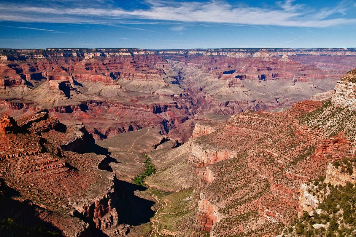
Few landscapes on Earth inspire awe quite like Grand Canyon National Park. Carved over millions of years by the Colorado River, this immense canyon stretches more than 270 miles long and reaches depths of over a mile. Layer upon layer of red, orange, and purple rock tells a geological story that spans nearly two billion years.
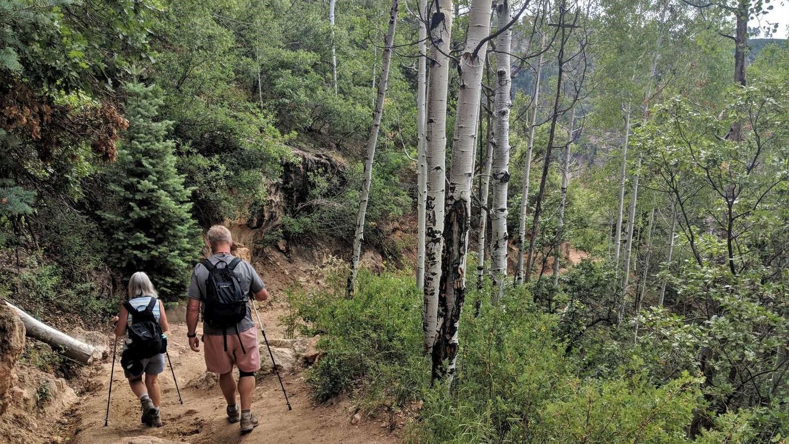
While many visitors simply admire the canyon from the rim, the true magic of the park reveals itself on the trails. Hiking into the canyon allows you to experience its vast scale, changing ecosystems, and incredible viewpoints that cannot be seen from overlooks alone. Whether you’re looking for a short scenic walk or a challenging adventure descending toward the Colorado River, the Grand Canyon National Park hikes offer something for every skill level.
This detailed Grand Canyon National Park travel guide covers the best hiking trails, top attractions, when to visit, where to stay, and essential tips to help you plan a safe and unforgettable trip.
Where Is Grand Canyon National Park


Grand Canyon National Park is located in northern Arizona, United States, near the borders of Utah and Nevada. The park is roughly:
- 3.5 hours from Phoenix
- 2 hours from Flagstaff
- 4.5 hours from Las Vegas
The park is divided into two primary visitor areas:
South Rim
The South Rim is the most visited area and is open year-round. It includes the main visitor center, historic lodges, and many of the most famous viewpoints. Most popular Grand Canyon National Park hikes start here.
North Rim
The North Rim sits about 1,000 feet higher in elevation and receives far fewer visitors. Because of heavy snowfall, it is usually open only from mid-May through mid-October.
Although both rims offer incredible scenery, most travelers planning to visit Grand Canyon National Park choose the South Rim due to easier access and better facilities.
Best Time to Visit Grand Canyon National Park
The canyon can be visited year-round, but each season offers a different experience.
Spring (March – May)
Spring is one of the best seasons for hiking. Temperatures are mild, and wildflowers bloom along the rim. The inner canyon begins warming up but remains manageable for longer hikes.
Summer (June – August)
Summer is the busiest season in the park. While temperatures on the rim may feel comfortable, the inner canyon can reach over 100°F (38°C). If hiking during summer, start early in the morning and carry plenty of water.
Fall (September – November)
Fall is another excellent season for hiking. Crowds begin to thin after Labor Day, and cooler temperatures make it easier to explore longer trails.
Winter (December – February)
Winter brings snow to the canyon rim, creating dramatic scenery. While some trails can become icy, the park is far less crowded and offers a peaceful experience.
Top Attractions in Grand Canyon National Park
Before heading onto the trails, explore some of the park’s most famous landmarks.
Mather Point
Located near the visitor center, Mather Point is often the first viewpoint visitors see. It offers sweeping views across the canyon and is one of the most photographed locations in the park.
Yavapai Observation Station
This viewpoint includes educational exhibits explaining the geology of the canyon and offers one of the best panoramic views on the South Rim.
Desert View Watchtower
Built in 1932, this historic stone tower provides elevated views across the canyon and toward the Colorado River.
Grand Canyon Village
This is the main hub on the South Rim where visitors will find restaurants, hotels, museums, and shuttle bus stops connecting the park’s main trails.
Best Hikes in Grand Canyon National Park
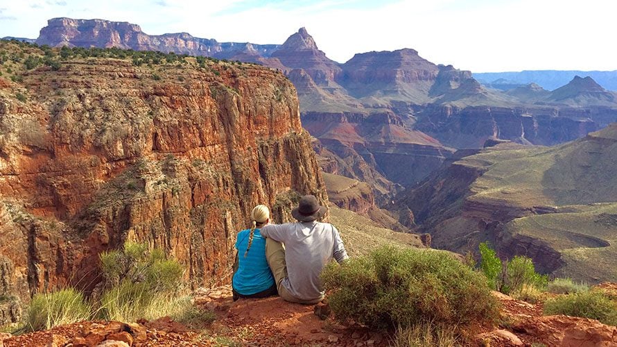
1. Bright Angel Trail


Distance: Up to 9.5 miles to the Colorado River
Difficulty: Strenuous
Elevation change: ~4,380 feet
The Bright Angel Trail is the most popular hiking trail in the park and offers one of the safest ways to descend into the canyon. It begins near Grand Canyon Village and follows a historic route used for more than a century.
Unlike other trails, Bright Angel provides seasonal water stations and rest houses along the way.
Trail Highlights
- Spectacular canyon switchbacks
- Shaded sections along the route
- Havasupai Gardens oasis
- Plateau Point overlooking the Colorado River
Recommended Turnaround Points
Most hikers do shorter out-and-back hikes rather than going all the way to the river.
1.5 Mile Resthouse
Distance: 3 miles round trip
3 Mile Resthouse
Distance: 6 miles round trip
Havasupai Gardens
Distance: 9 miles round trip
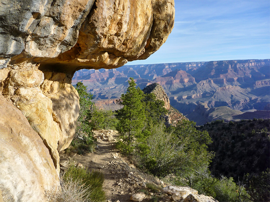
2. South Kaibab Trail


Distance: 7 miles to the Colorado River
Difficulty: Strenuous
The South Kaibab Trail is widely considered the most scenic trail in the park because it follows a ridgeline with panoramic views throughout the entire hike.
Unlike Bright Angel Trail, there is no water available on this route, and the trail is fully exposed to the sun.
Best Stops Along the Trail
Ooh Aah Point
Distance: 1.8 miles round trip
One of the most popular sunrise hikes in the canyon.
Cedar Ridge
Distance: 3 miles round trip
A wide scenic viewpoint with rest areas.
Skeleton Point
Distance: 6 miles round trip
Offers a clear view of the Colorado River without hiking to the bottom.
3. Rim Trail

Distance: Up to 13 miles
Difficulty: Easy
The Rim Trail is the easiest hiking option in the park and runs along the canyon edge connecting many famous viewpoints.
This mostly paved trail is ideal for families, casual walkers, and photographers.
Trail Highlights
- Continuous canyon views
- Accessible sections for wheelchairs and strollers
- Shuttle stops along the route
- Excellent sunrise and sunset viewpoints
4. North Kaibab Trail

Distance: 14 miles to the Colorado River
Difficulty: Very strenuous
The North Kaibab Trail is the only trail descending from the North Rim into the canyon. Because the North Rim receives far fewer visitors, the trail offers a quieter wilderness experience.
Trail Highlights
- Roaring Springs waterfall
- Forested sections near the rim
- Access to Phantom Ranch
- Part of the famous Rim-to-Rim hike
5. Grandview Trail
Distance: 6 miles round trip
Difficulty: Strenuous
Grandview Trail was originally built by miners in the late 1800s and remains one of the steepest trails on the South Rim.
Trail Highlights
- Horseshoe Mesa views
- Historic mining ruins
- Rugged terrain with fewer crowds
Grand Canyon National Park Map and Travel Tips
Use the Shuttle System
The South Rim shuttle buses connect major viewpoints and trailheads. Using the shuttle helps avoid parking issues during peak seasons.
Start Early
Temperatures inside the canyon rise quickly during the day. Many experienced hikers start before sunrise.
Carry Plenty of Water
The desert environment can quickly lead to dehydration. Always carry at least 2–3 liters of water per person.
Know Your Limits
The biggest mistake visitors make is hiking too far down and struggling to climb back out.
Where to Stay Near Grand Canyon National Park
Inside the Park
Staying inside the park allows easy access to sunrise viewpoints and hiking trails.
Popular options include:
- El Tovar Hotel
- Bright Angel Lodge
- Maswik Lodge
- Mather Campground
Tusayan
Located just outside the South Rim entrance, Tusayan offers hotels, restaurants, and guided tour services.
Flagstaff
Flagstaff is about 90 minutes away and provides a larger selection of accommodations and restaurants.
Frequently Asked Questions
What is the best hike in Grand Canyon National Park?
Bright Angel Trail and South Kaibab Trail are widely considered the best hikes because they provide dramatic canyon views and access to the inner canyon.
How many days should I spend at the Grand Canyon?
Most visitors spend 2–3 days exploring viewpoints and hiking trails.
Can beginners hike in the Grand Canyon?
Yes. The Rim Trail and short sections of Bright Angel Trail are suitable for beginners.
Do you need permits to hike the Grand Canyon?
Day hikes do not require permits, but overnight backpacking trips require a backcountry permit.
Is hiking to the bottom of the canyon difficult?
Yes. Descending to the Colorado River involves steep trails and extreme elevation changes.
Conclusion
Hiking in Grand Canyon National Park offers one of the most unforgettable outdoor experiences in the world. From easy scenic walks along the rim to challenging descents deep into the canyon, every trail reveals a new perspective of this natural wonder.
If it’s your first visit, start with the Rim Trail or South Kaibab Trail to Ooh Aah Point. More experienced hikers can challenge themselves with Bright Angel Trail or the North Kaibab Trail.
With proper planning, plenty of water, and an early start, exploring the canyon’s trails will become a highlight of your national park adventures.
You Can Also Visit
- Best National Parks in the USA
Target:/best-national-parks-usa
Reason: Pillar article connecting all park guides. - Zion National Park hiking guide
Target:/zion-national-park-hiking-guide
Reason: Related hiking destination. - Yosemite best hikes
Target:/best-hikes-yosemite-national-park
Reason: Similar hiking audience. - National park packing list
Target:/national-park-hiking-packing-list
Reason: Helpful preparation guide. - Arizona road trip itinerary
Target:/arizona-national-parks-road-trip
Reason: Regional travel guide.